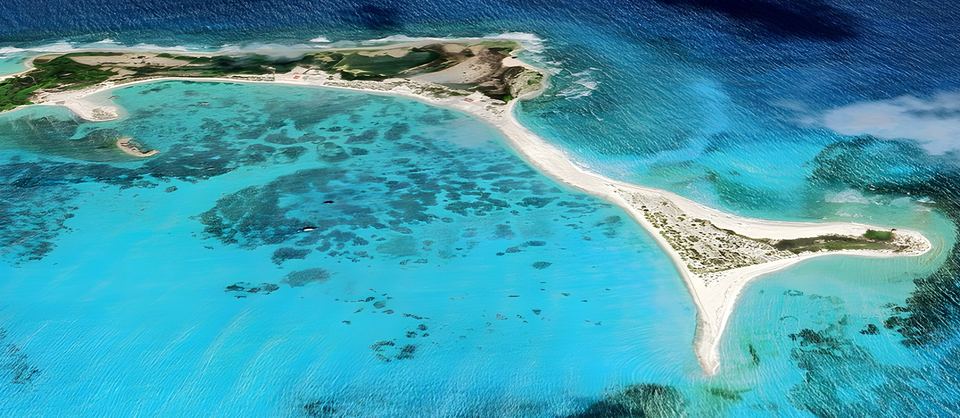
Aerial view of the horseshoe-shaped sand spit of Cayo Herradura and its turquoise bay

Landmarks · Cay

Cayo Herradura

A horseshoe-shaped sand spit with a calm bay of turquoise water.

Image: Google Earth

North and north-west of the main island lie La Tortuga's cays: Cayo Herradura and the two Tortuguillos. Cayo Herradura ("Horseshoe Cay") is a sand spit about 1,600 m long and 60–400 m wide; its calm inner beach forms a bay where visitors often arrive by sailing boat and motor boat.

Length
≈ 1,600 msand spit
Width
60–400 m
From Higuerote
≈ 50 nm3½–4½ h by fast launch
Visitors
100 a daylimit set in 2013

The cay

It has some patches of low scrub. It is the most visited of La Tortuga's cays: the island's tourist activity is concentrated on its beach, and its lighthouse stands at the western end. It is a tall tower with horizontal white and red bands which, according to a sailors' guide, is easy to see by day and a reference for rounding the north-west point; behind the sand spit, yachts anchor on sand in about 2–4 m of water. It is number 3 on the Landmarks map.
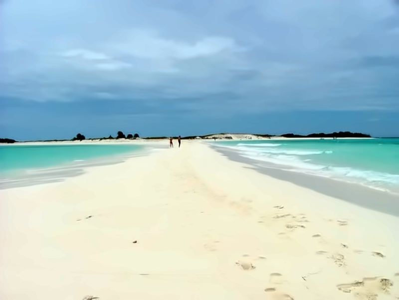
White sand spit of Cayo Herradura between turquoise waters, with two people in the distance
The white sand spit of Cayo Herradura.
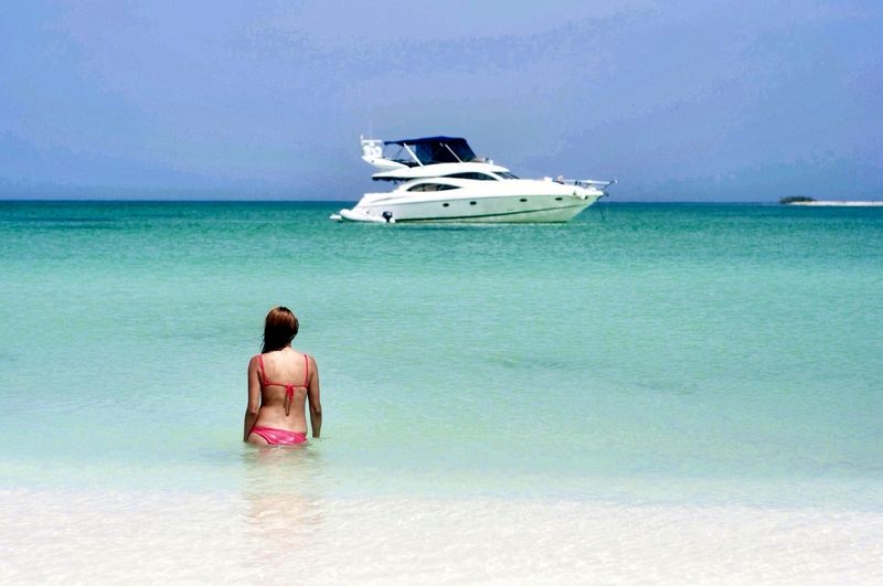
Shallow turquoise water at Cayo Herradura, with a swimmer and an anchored yacht
Shallow turquoise water at the cay.

Under water

The island has important coral reefs, lush mangroves and extensive seagrass meadows. Turtle grass (Thalassia testudinum) forms the meadows where green turtles graze, and Cayo Herradura had the meadows in the best condition. Dive groups also come to the cay and make short trips from there to the coral barriers and the drop-offs south of the main island.
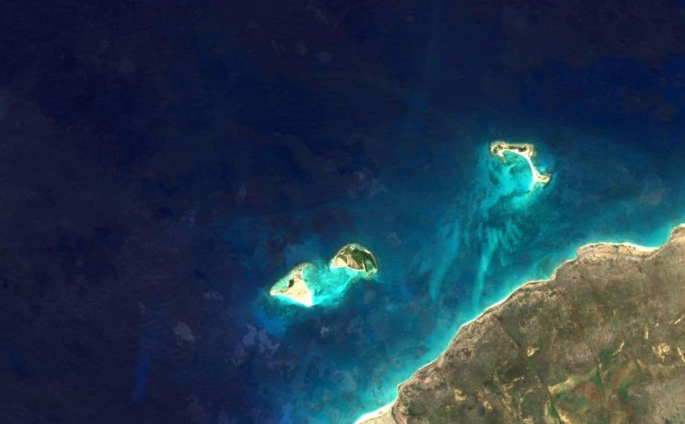
Satellite image of Cayo Herradura and Los Tortuguillos, north-west of La Tortuga
Cayo Herradura and Los Tortuguillos, north-west of La Tortuga, in a satellite image.

Birds

Between August and December, a shorebird census of five wetlands on the island and two cays, Herradura and Tortuguillo Este, counted 987 birds of 20 species. The cay was also part of a study of seabird nesting on La Tortuga. More on Species.

Fishing

Seasonal fishers work La Tortuga and its cays from three camps: Punta del Este, Carenero and Cayo Herradura. The main grounds run along the north from Cayo Herradura to Punta Delgada and off the east of the island. More on Fishing & sports.

Getting there

Higuerote is the traditional departure point. Cayo Herradura is about 50 nautical miles away: in a fast launch, in the usual choppy sea, the crossing takes 3½–4½ hours, and 9–11 hours under sail; longer in rough weather. From Lechería and Puerto La Cruz it is about 115 km (62 nm) in a straight line, an approximate figure we calculated from coordinates.

Some of the cay's camps depart from Higuerote and include snorkelling and trips to nearby cays. You'll find camps and operators in the Directory and the routes on Getting There.

Visitor rules

The resolution published in Gaceta Oficial No. 40,259 (2013), to run for up to two years, made Cayo Herradura a visitor area with at most 100 visitors a day, set the anchorage 50 m from shore and requires you to take your rubbish back to the mainland. Check the current rules before you sail: more on Plan your trip.

Sources
  1. Marín Espinoza, G. et al. (2011). «Diversidad de aves playeras (Charadriiformes) asociadas a humedales de la isla La Tortuga y sus cayos». Boletín del Instituto Oceanográfico de Venezuela 50(1): 49–57. https://desarrollosustentableve.com/wp-content/uploads/Marin-et-al-2011-Diversidad-La-Tortuga.pdf
  2. Higuerote Online: «A dónde llegar en la Isla de La Tortuga» (Cayo Herradura). https://higueroteonline.com/a-donde-llegar-en-la-isla-de-la-tortuga/
  3. El Universal, Guía turística: «La Tortuga». https://www.eluniversal.com/guia-turistica/22399/la-tortuga
  4. Banik (velero): «Cayo Herradura», guía de fondeo (en francés). https://www.banik.org/mouillag/Herradura.htm
  5. Venezuela Tuya: «Tortugas, especies ancestrales». https://www.venezuelatuya.com/natura/tortugasespeciesancentrales.htm
  6. «Caracterización de los bosques de manglar y las praderas de Thalassia testudinum de la Isla La Tortuga y cayos adyacentes, Venezuela», Aquadocs. http://hdl.handle.net/1834/3832
  7. Marín-Espinoza, G., Carvajal, Y. & Voglar, J. «Anidación de aves marinas en isla La Tortuga, cayo Herradura y cayo Tortuguillo Este, Venezuela». Boletín del Instituto Oceanográfico de Venezuela. https://iov-udo.com/revista/index.php/boletin57-1/article/view/186
  8. Giménez Hurtado, E. et al. (2010). «Situación actual de la pesca artesanal en las Dependencias Federales: Isla La Tortuga, Las Tortuguillas, Cayo Herradura y Los Palanquines». Boletín del Centro de Investigaciones Biológicas 44(4): 441–460, Universidad del Zulia. https://produccioncientificaluz.org/index.php/boletin/article/view/281
  9. islalatortuga.com: sea-route distances measured along approximate routes (haversine, 1 nmi = 1.852 km) from approximate coordinates: Higuerote 10.49 N, 66.075 W; El Morro de Lechería 10.228 N, 64.695 W; Porlamar 10.94 N, 63.85 W; Cayo Herradura 10.97 N, 65.38 W; Playa Caldera (Punta Delgada) 10.925 N, 65.20 W. Transit times = distance ÷ average speed in typical choppy seas, about 13 kn (fast launch) and 5 kn (sailing yacht), rounded to ranges. https://www.movable-type.co.uk/scripts/latlong.html
  10. islalatortuga.com: great-circle (haversine) distances calculated from approximate coordinates: El Morro de Lechería 10.195 N, 64.690 W; Puerto La Cruz 10.214 N, 64.632 W; Punta Delgada 10.925 N, 65.20 W; Cayo Herradura 10.97 N, 65.38 W. 1 nautical mile = 1.852 km. https://www.movable-type.co.uk/scripts/latlong.html
  11. Alastour Viajes y Turismo: «Isla La Tortuga Paquetes Todo Incluído». https://alastour.site/isla-latortuga/
  12. Resolución conjunta MINTUR DM-087 / MPPRIJP DM-355, Gaceta Oficial N.º 40.259 (26 Sep 2013): usage rules for La Tortuga, Los Tortuguillos, Cayo Herradura and Los Palanquines (text as transcribed by ONSA Venezuela). https://www.onsa.org.ve/comunidad/forum/viewtopic.php?t=2349
Photo credits

All images and licences →